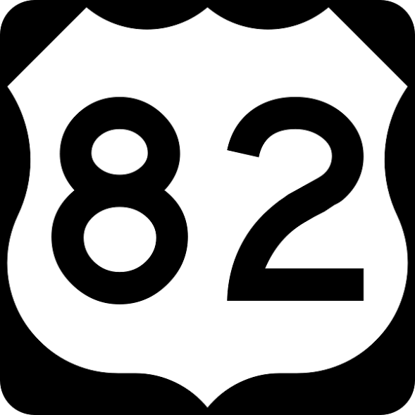
U.S. Route 82 or U.S. Highway 82 (US 82) is an east–west United States highway in the Southern United States. Created on July 1, 1931 across central Mississippi and southern Arkansas, US 82 eventually became a 1,625-mile (2,615 km) route extending from the White Sands of New Mexico to Georgia's Atlantic coast.
The highway's eastern terminus is in Brunswick, Georgia, at an intersection with Interstate 95. It is co-signed for its last half-mile with U.S. Route 17. Its western terminus is in Alamogordo, New Mexico at an intersection with U.S. Route 54 and U.S. Route 70.
Route description[]
New Mexico[]
US 82 begins at an intersection with U.S. Highways 54 and 70 north of Alamogordo, and south of La Luz, New Mexico. Heading east out of Alamogordo the road ascends into the Sacramento Mountains, traveling through the Lincoln National Forest. While climbing steep Mexican Canyon, the highway passes the abandoned railroad trestles of the El Paso and Northeastern Railway, and passes through the only road tunnel in New Mexico. The road then traverses the New Mexico villages of High Rolls, Cloudcroft, and Mayhill. After descending the mountains into the rugged, flat plains of eastern New Mexico, it generally follows a north-northeasterly bearing until Artesia, where it takes a more due-easterly bearing on through to Lovington, veering back slightly to the north before crossing into Texas.
Texas[]
US 82 crosses into Texas from New Mexico at Texas Farm to Market Road 769, turning northeastward toward Plains, where it merges with US 380. US 82 is co-signed with US 380 from Plains to Brownfield, where it joins US 62, and US 380 leaves the route. US 82/62 continues northeastward toward Lubbock, having an interchange with Interstate 27.
In Lubbock, US 82 and US 62 split, where US 82 is a limited access freeway west of US Route 87. From Wolfforth to downtown Lubbock, US 82 is named Marsha Sharp Freeway after Marsha Sharp, former head basketball coach of the Texas Tech Lady Raiders and Women's Basketball Hall of Fame inductee. It once again merges with US 62 (along with State Highway 114) east of the campus of Texas Tech University, where it continues eastward through Ralls, where US 62 makes a sharp turn to the north and leaves the route. US 82 continues eastward across the level plains of the Llano Estacado to Crosbyton and then dips downward as it crosses the White River of Blanco Canyon, where the Texas Department of Transportation maintains the Silver Falls Rest Area with facilities and hiking trails. After climbing out of Blanco Canyon, US 82 eventually exits the Llano Estacado and enters the rolling plains near Dickens, Texas.
US 82/TX 114 continues eastward as a co-signed route until Seymour, where it merges with U.S. Highways 183, 277 and 283, with US 183 and 283 leaving the route at Mabelle. US 82/277 continues eastward to Wichita Falls, merging with US 287 just south of downtown and having an interchange with Interstate 44. US 82 leaves US 287 at Henrietta and continues east, signed independently (apart from various state highway routes) across the remainder of Texas, crossing into Arkansas in downtown Texarkana and an interchange with Interstate 30.
Arkansas[]
US 82 enters Arkansas in downtown Texarkana, then proceeds almost due east across the flat plains of the Red River. It crosses the Red River at Garland City on a new bridge, then passes through the towns of Lewisville and Magnolia. At Magnolia, the route joins US 79 for approximately two miles before continuing eastward. The route passes through the cities of El Dorado and Strong before crossing the Ouachita River just north of Lake Jack Lee, then continues through Crossett and Hamburg to Lake Village. The route continues from there across the Mississippi River to Greenville, MS through Greenville Bridge. US 82 closely follows the historical alignment of Arkansas Highway 2.
Mississippi[]
Through the entire state, the highway is four-laned with interchanges at major junctions. After crossing the Mississippi River from Arkansas via a four-laned, cable-stayed Mississippi River bridge, the road briefly travels northeast toward central Greenville, then turns east to Columbus, passing through Indianola, Greenwood, Winona, and Starkville, while bypassing Itta Bena.
According to the Mississippi Department of Transportation's website www.gomdot.com, construction is now underway on a U.S. 82 bypass around Greenville. The new road will commence at the recently opened MS River Bridge and terminate at the current U.S. 82 near Leland, creating a half-loop freeway around South Greenville. Cloverleaf interchanges are presently being built at the freeway's junctions with MS 454 and MS 1. This new bypass will be the southern terminus for the planned freeway connector to Interstate 69, which is also under construction through the northern Mississippi Delta.
From Starkville east through Columbus and on to the Alabama state line, US 82 is built to freeway standards. The Mississippi section of U.S. 82 is defined in Mississippi Code Annotated § 65-3-3.
Alabama[]
Throughout Alabama, US 82 is paired with unsigned State Route 6 (AL 6). The highway enters the state east of Columbus, Mississippi, and bears southeast towards Northport and Tuscaloosa, where it crosses over I-20 and I-59 south of town. It is known in West Alabama as McFarland Boulevard, in memory of the late Honorable Ward Wharton McFarland, a political, business, and civic leader who died in 1979. After leaving Tuscaloosa, the route continues southeast, passing through the cities of Brent, Centreville, and Maplesville en route to Prattville, on the northern edge of the Montgomery metropolitan area. This approximately 92-mile (148 km) drive goes through some of the most rural areas of the state, much of it two lanes with the exception of the section from Tuscaloosa to Centreville. Upon arriving in Prattville, it runs concurrently with I-65, with which it goes through downtown Montgomery with (also junctioning with the current southern terminus of I-85), and splits off to the east south of downtown. After leaving Montgomery, the route continues southeast through Union Springs and Midway en route to Eufaula, on the Alabama–Georgia state line, where it junctions with US 431. The route then crosses over the Chattahoochee River into Georgetown, Georgia, over Lake Eufaula.
Currently in Pickens County, Alabama, a widening project of US 82 is underway to make the highway four lanes. New bridges are being constructed using Federal Highway Administration monies, as well as matching Alabama Department of Transportation funds. Four-laning the highway in Tuscaloosa County, west of Northport to the Pickens County line, was completed in the fall of 2010. The highway is now four lanes from the Mississippi state line to just southeast of Centreville at mile marker 88.
Georgia[]
Throughout much of southern Georgia, US 82 is paired with State Route 520 and designated as "Corridor Z" and "South Georgia Parkway." West of Dawson, US 82 is paired with State Route 50, the historic State Route number for US 82 in Georgia. From Albany onwards, US 82 becomes a four-lane highway as it moves through Albany and then onto Tifton where US 82 intersects with I-75. After this, the highway moves east through southern plains and Waycross, near the Okefenokee Swamp. US 82 then proceeds to Brunswick, where it terminates at the intersection with I-95.
History[]
During the initial creation of the US Highway System, the US 82 designation was unassigned. The Mississippi Highway Department requested the creation of a route between Greenville and Columbus, additionally proposing that it should be extended eastward to Birmingham, Alabama, and into Arkansas. The American Association of State Highway Officials (AASHO) initially balked at the request because it was not accompanied by concurrent requests from Arkansas or Alabama, and because the proposed route utilized several private toll bridges. Following concurrence from Arkansas, the route was approved on July 1, 1931. In Arkansas, US 82 completely replaced Highway 2, running from the Mississippi River to US 71 in Texarkana. US 82 was extended east into Alabama and west into Texas in 1934; making US 82 a 946-mile (1,522 km) route from US 385 in Lubbock to US 11 in Tuscaloosa. Over the next eight years, construction and other routing improvements reduced the total length to 904-mile (1,455 km). In 1948, the route was extended east to Waycross, Georgia, with an extension east to US 17 in Midway, Georgia eight years later.
On November 26, 1960, an extension to Las Cruces, New Mexico was denied due to substandard roadway conditions in New Mexico, but was later approved on June 18, 1963. The route was extended east to I-95 in Chester, Georgia on June 25, 1979. The east ends of US 82 and U.S. Route 84 were swapped in 1989 after the roads around Waycross, Georgia, were reconfigured. This change made US 82's eastern terminus I-95 in Brunswick, Georgia, which is the current terminus today. New Mexico decided to delete an overlap with US 70 between Alamogordo and Las Cruces, resulting in the current western terminus at US 54/US 70.
In the 1977 movie Smokey and the Bandit, it was the main route to Texarkana from Atlanta and back.
Future[]
U.S. Route 82 is proposed to have an interchange with Interstate 69 in the near future.
The highway is also receiving a new routing to bypass Greenville, Mississippi.
Major intersections[]
Special routes[]
Twelve special routes of US 82 currently exist: four in Arkansas, four in Texas, two in New Mexico, one in Mississippi, and one in Georgia.
See also[]
- Mississippi Highway 182
- Texas State Highway 56
- U.S. Route 80
- U.S. Route 84
- U.S. Route 90
  |
|---|
| 1 • 2 • 3 • 4 • 5 • 6 • 7 • 8 • 9 • 10 • 11 • 12 • 13 • 14 • 15 • 16 • 17 • 18 • 19 • 20 • 21 • 22 • 23 • 24 • 25 • 26 • 27 • 28 • 29 • 30 • 31 • 32 • 33 • 34 • 35 • 36 • 37 • 38 • 39 • 40 • 41 • 42 • 43 • 44 • 45 • 46 • 47 • 48 (CA • WV–MD • WV–VA) • 49 • 50 • 51 • 52 • 53 • 54 • 55 • 56 • 57 • 58 • 59 • 60 • 61 • 62 • 63 • 64 • 65 • 66 • 67 • 68 • 69 • 70 • 71 • 72 • 73 • 74 • 75 • 76 • 77 • 78 • 79 • 80 • 81 • 82 • 83 • 84 • 85 • 86 • 87 • 88 • 89 • 90 • 91 • 92 • 93 • 94 • 95 • 96 (1926–1939 • 1939–Current) • 97 • 98 • 99 • 101 • 163 • 400 • 412 • 425 |
| Primary routes • Auxiliary routes • Divided routes • Special routes • Intrastate routes • Former routes • Intrastate • Hypothetical (Auxiliary • Special) |
| Major U.S Routes are written in bold. Former U.S. Routes that are no longer part of the system are written in italic. |
|---|